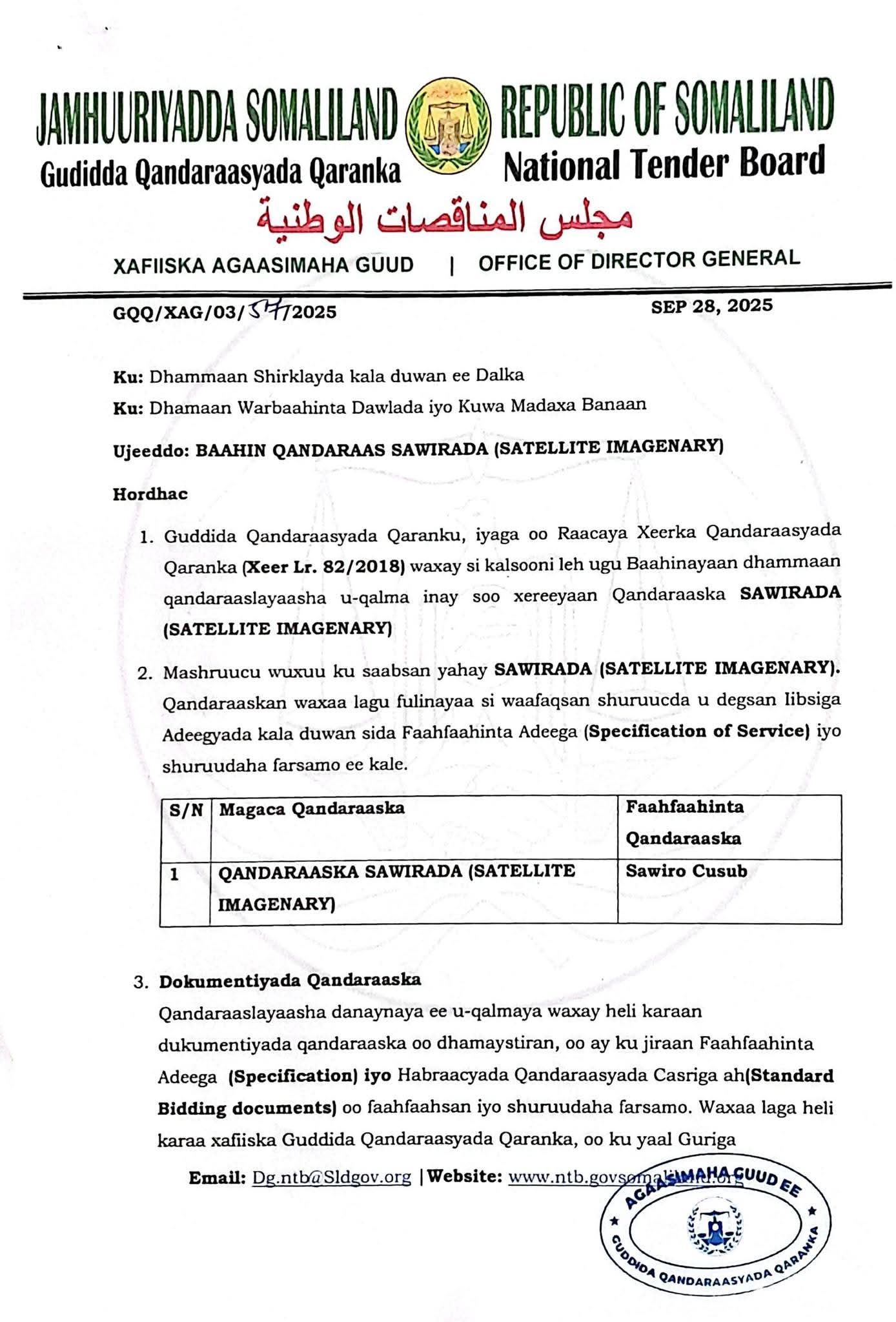
Somaliland's National Tender Board announces an open tender for advanced satellite imagery services to enhance national planning, development, and security.
×
![Enlarged view of Somaliland National Tender Board announcement]()
The tender, announced under the authority of the National Procurement Law (Keer Lr. 82/2018), represents a key step in Somaliland’s plan to strengthen its data-driven decision making. According to the NTB, the project seeks to secure updated and comprehensive satellite images capable of guiding urban expansion, monitoring natural resources, improving disaster preparedness, and supporting critical infrastructure projects.
Officials explained that the government is looking for contractors with proven technical capacity and a strong track record in satellite imaging and geospatial services. “This initiative will give Somaliland the ability to access accurate, timely, and detailed geographic information—essential for modern governance and long-term planning,” said Director General Cabdiraxmaan Aadan Cilmi (Boodhle), who signed the public notice.
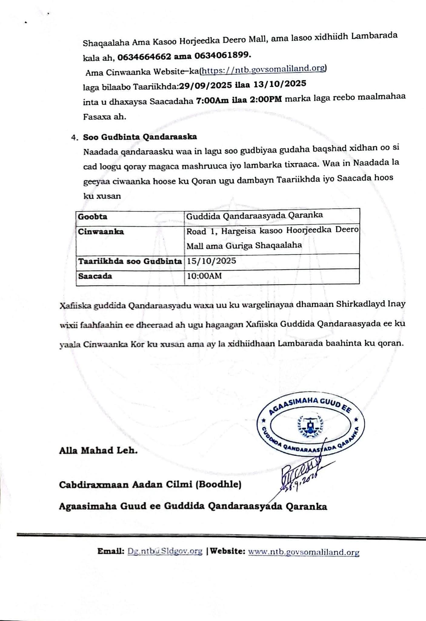
The Board has made complete bidding documents available to interested firms. These documents include full technical specifications, service requirements, and the latest standard procurement procedures. They can be obtained at the National Tender Board headquarters opposite Deero Mall in Hargeisa from September 29 to October 13, 2025, between 7:00 a.m. and 2:00 p.m. local time, excluding public holidays.
Companies intending to bid must submit their proposals in sealed envelopes clearly marked with the project name and reference number. All submissions must reach the National Tender Board office no later than 10:00 a.m. on October 15, 2025. The NTB stressed that late bids will not be considered, ensuring a fair and transparent process.
For further details or clarifications, prospective bidders may contact the Board at 063-466-4662 or 063-406-1899, or visit Somaliland National Tender Website .
Government officials say the satellite imagery project underscores Somaliland’s growing emphasis on technology and evidence-based policy. By investing in advanced geospatial data, the country aims to improve land management, track environmental changes, and strengthen national security, while also creating opportunities for private sector firms to contribute expertise and innovation.
Observers view the initiative as another signal of Somaliland’s intention to integrate cutting-edge technology into public service delivery, positioning the nation to respond more effectively to urban growth and environmental challenges in the years ahead.

Somaliland’s National Tender Board Announces Open Tender for Advanced Satellite Imagery Services
Official Press Release
Hargeisa, Somaliland — September 28, 2025